Daphne's Official Zoning Map Up for Revision to Capture Recent Growth
An updated version of the city's official zoning map is advancing at Daphne City Hall, listed for a public hearing and a first reading of the adopting ordinance on the June 1 council agenda. The revision consolidates the annexations, pre-zonings and rezonings the city approved between November and April.
Daphne is moving to adopt an updated version of its official zoning map, with the City Council set to hold a public hearing where residents can comment before a vote.
The zoning map is the city's official record of how land across Daphne may be used — which parcels are set aside for single-family homes, businesses, industry or planned developments. For a property owner, it is the document that governs what can be built on a given lot. The map is kept as an exhibit to the city's Land Use and Development Ordinance, and the council re-adopts it periodically to incorporate the changes approved since the previous version.
Agenda excerpt, Daphne City Council business meeting, June 1, 2026, page 1.
On the June 1 agenda, the map update is listed for a public hearing and, separately, for a first reading of the ordinance that would adopt it, Ordinance 2026-17. The council's earlier May 4 agenda, however, listed a motion to publish notice and set the public hearing on the map for June 15. Because the date appears differently across the two records, residents who want to comment should confirm it with the city before attending.
According to the meeting packet, the new map gathers the annexations, pre-zonings and rezonings the city approved between November 2025 and April 2026. The Planning Commission voted unanimously on April 23 to recommend that the council adopt it.
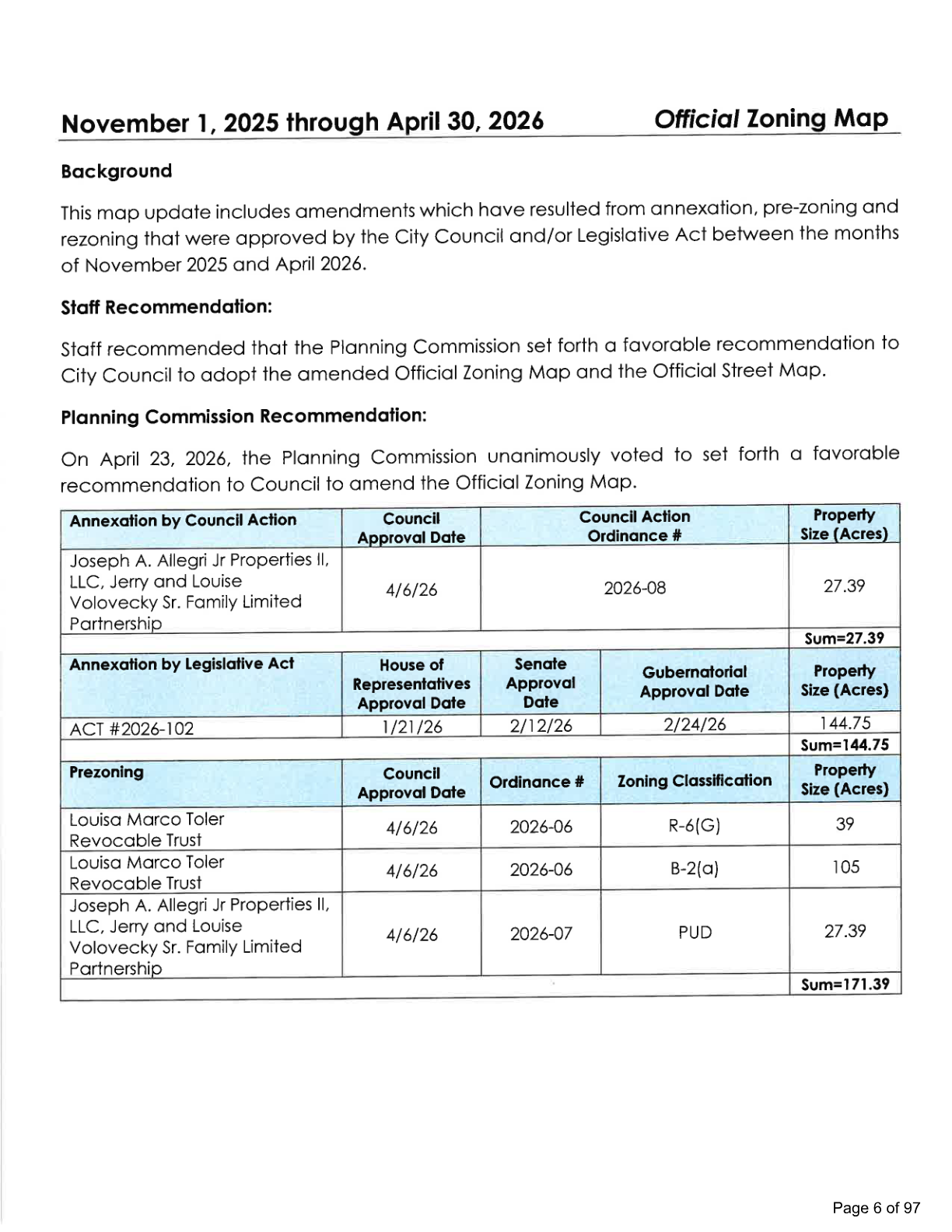
Official Zoning Map update summary, June 1 meeting packet, page 6.
The packet lists the specific changes the map would reflect: an annexation of about 27 acres approved by the council, a separate annexation of about 145 acres approved by an act of the Alabama Legislature, and pre-zonings totaling about 171 acres in categories that include single-family residential, business and planned-unit-development zoning. Pre-zoning assigns a zoning category to property, typically land being brought into the city.
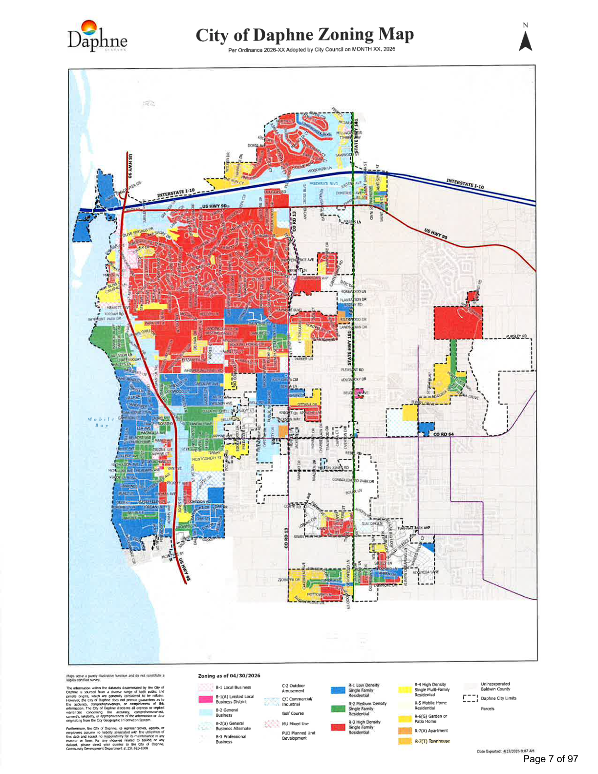
Proposed City of Daphne zoning map, June 1 meeting packet, page 7.
The most recent version of the official map was adopted Jan. 20 under Ordinance 2026-01, after a public hearing in January; it incorporated changes made since an April 2025 update. The current adopted map is posted on the city's Community Development maps page.
The same agenda carries other land-use measures, including a proposed temporary moratorium on certain new multi-family residential applications. Daphne City Council meetings are held at City Hall, 1705 Main Street.